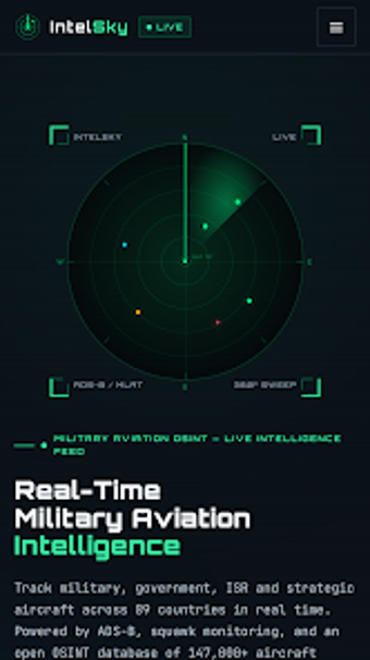
Android app for live monitoring of military and government aircraft
IntelSky, developed by Talal Nahle, is an Android OSINT app that tracks military, government and ISR flights in real time. The app displays live radar positions, altitude, speed, callsigns and registration, plus historical route reconstruction and multi-track playback. Intended for OSINT researchers, journalists and aviation enthusiasts, it supplies detailed aircraft records and automatic live tracks without ads or paywalls, while the developer notes it must not be used for navigation or operational decision-making.
What the app does and the audience it serves
IntelSky is a specialist aviation monitor focused on non-commercial traffic, feeding public ADS-B data into a global radar filtered for military, government and ISR aircraft. The tool targets open-source intelligence researchers, journalists and aviation hobbyists by offering mission-type tagging and an aircraft database tailored to strategic aviation rather than passenger flights. Its design assumes investigative and analytical use, not in-flight guidance.
How accurate and continuous the tracking is
The platform shows real-time flight details such as altitude, speed and callsign and offers historical flight-path reconstruction with multi-track playback. It also provides automatic live flight tracks with smooth gap connections, which supports continuous monitoring of an aircraft’s recent movements. The developer cautions that data may be delayed or estimated, and explicitly states the app is not suitable for navigation or emergency decisions.
Device compatibility and mobile behaviour
The application runs on Android and is regularly updated for current versions, presenting a responsive mobile interface optimized for handheld use. The app operates as a local Android client aggregating public ADS-B signals on the device; it is distributed without advertisements or paywalls, and does not require corporate integration to access its aircraft records and live feeds.
Intended use cases, limits and policy context
IntelSky is designed for OSINT workflows, archival research and enthusiast monitoring, featuring filters by date, region, operator and ICAO hex codes to refine searches. The developer’s documentation stresses legitimate analytical use and warns users they are responsible for complying with platform terms and local regulations. Some location or platform detection rules inside third-party services may override or ignore simulated or reported data, so the app’s output is best treated as investigative information rather than operational guidance.
Practical judgement on suitability and constraints
IntelSky is a focused option for researchers and enthusiasts who need public ADS-B coverage of military and government flights and historical route reconstruction. Its ad-free Android client and multi-track playback support investigative workflows, though the data is intended for analysis rather than navigation. Users seeking tactical-grade, real-time operational feeds should note the developer’s explicit warning about delays and estimated values before relying on the app for time-sensitive decisions.